
I haven’t done much work on the Northern NSW route lately.
At least, that’s what I’ve been telling myself.
Every time I thought about writing another post, I looked at the project and went, nah, I haven’t really done enough since the last one.
Then I started going back through the screenshots.
North Grafton Station. The yard. South Grafton. The turntable. Testing trains. Broken track joins. Fixed track joins. A scenery file that apparently decided half the buildings on the route didn’t exist. A giant terrain spike sticking out of Grafton like the world’s worst tourist attraction.
And now I’m rebuilding an abattoir siding from a 1945 railway plan.
So, apparently I have been making progress.
North Grafton became an actual place
The last time I wrote about this project, I was still very much in the stage of learning TSRE5 while trying to push the North Coast Line south.
A lot of it was experimenting. Lay some track. Work out why it was floating. Work out why the terrain had swallowed it. Discover another keyboard shortcut. Accidentally do something I didn’t understand. Undo. Repeat.
Eventually, though, I reached North Grafton Station.
And that changed things.
Suddenly I wasn’t just following a railway alignment across satellite imagery anymore. There was a station, sidings, points, yard buildings and enough track spreading out in different directions that it actually started to look like a railway.
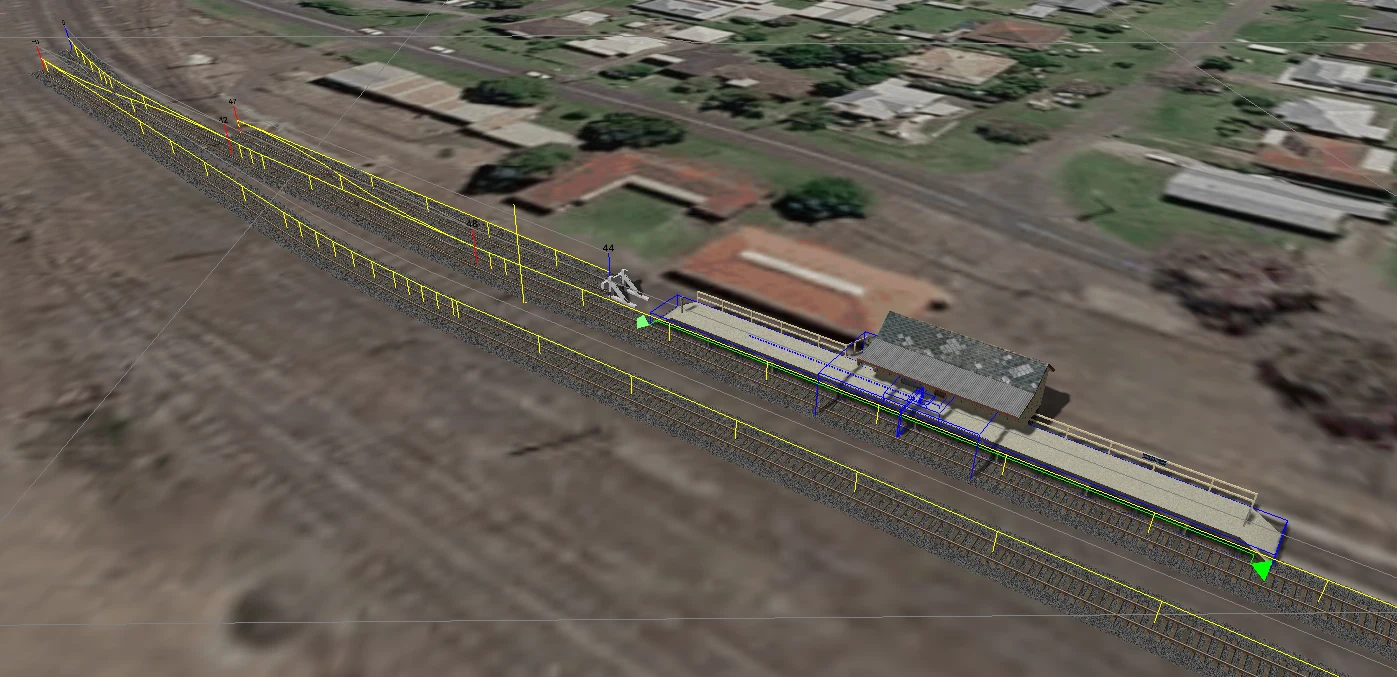
As the yard grew, I eventually measured what I had built from end to end.
5,196 metres of rail.
Five kilometres isn’t exactly going to challenge the full North Coast Line, but considering I started this project barely knowing which end of TSRE5 was which, I was pretty happy with that.
More importantly, I could actually drive over it.
Mostly.
The train became my QA department
Once North Grafton had enough railway to be useful, I stopped just flying around it in the editor and started testing it properly in Open Rails.
I grabbed a DR400 railmotor and went for a drive.
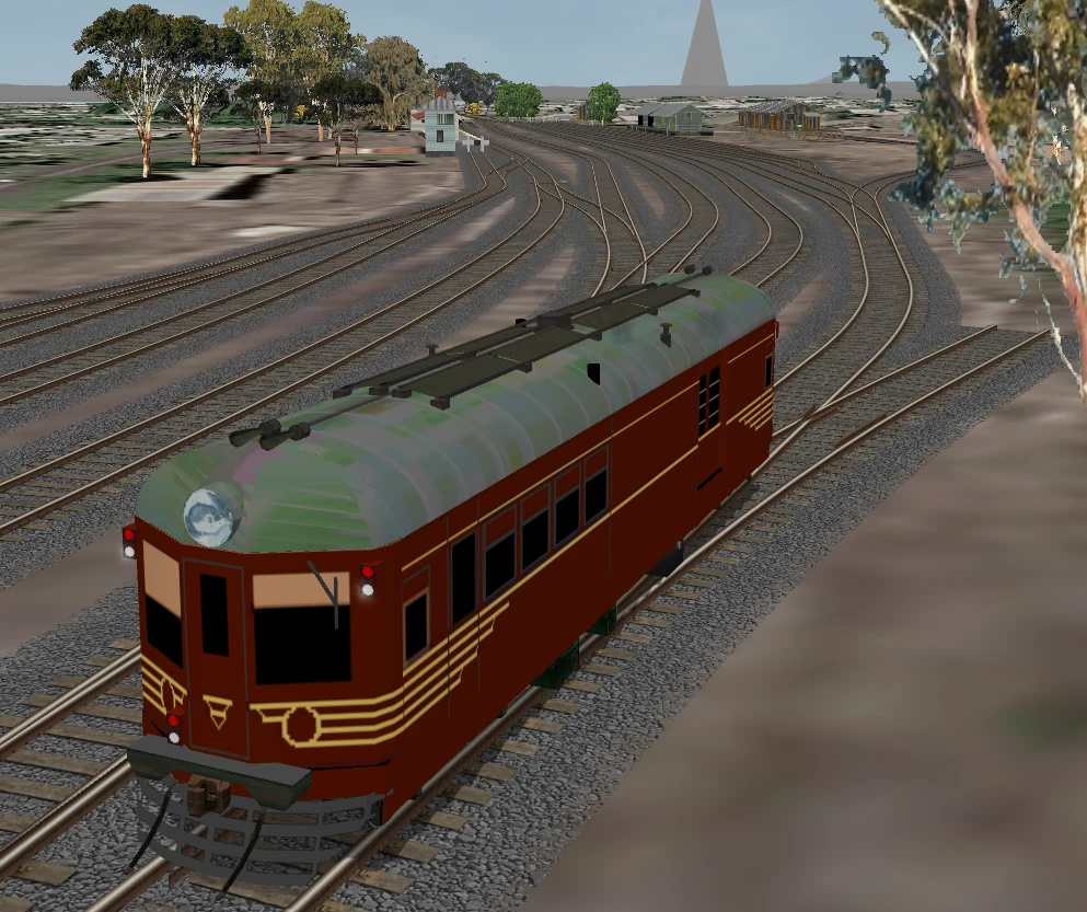
This was both a great idea and a terrible blow to my confidence.
From 100 metres above the ground in TSRE5, a track join can look absolutely perfect.
From rail level, travelling directly toward it?
Not so much.
I started finding overlapping track ends, tiny alignment problems and joins that looked connected but definitely had opinions about being driven over.
So the workflow quietly changed.
Build some track. Save it. Load Open Rails. Drive over it. Discover something stupid. Go back into TSRE5. Fix it. Try again.
At this point the rolling stock isn’t just there for screenshots. It is essentially the route’s QA department.
The track join from hell
One section deserves special mention because it fought me for far longer than it had any right to.
I had two track ends that needed to connect. From above, they looked fine. Almost perfectly aligned.
Except they weren’t.
The elevation was slightly different, just enough of a Y-axis mismatch that TSRE5 absolutely refused to cooperate.
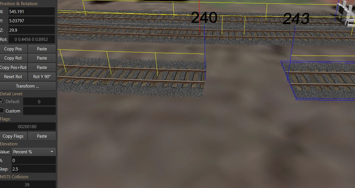
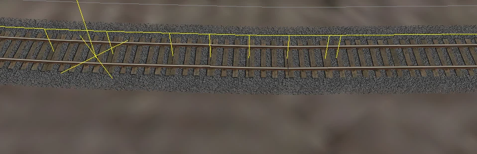
I tried moving things. Adjusting things. Rotating things. Looking at it from different angles as though a sufficiently disappointed stare might fix railway geometry.
Nothing.
Eventually I stopped trying to force normal track pieces to do the job and used a short section of dynamic track.
That worked.
It was also a useful little milestone because I’d been avoiding dynamic track wherever possible. It always felt like something I should only touch if absolutely necessary.
Turns out that’s pretty much exactly how I now use it.
If the normal track library gives me what I need, great. If not, dynamic track gets summoned.
We have reached an understanding.
I am slowly learning not to anger the TDB
The Track Database has also become considerably less mysterious.
Or at least I now know enough about it to be appropriately afraid of it.
That yellow line floating above the track means the section has been added to the TDB.
Earlier in the project I saw that and thought, excellent, finished.
Now I see it and think, do not touch that unless you know exactly what you’re doing.
I’ve become much more deliberate about removing track from the database with Z before making adjustments, getting everything where I want it, then adding it back afterward.
That one habit has prevented quite a few problems.
Moving track after the database thinks it lives somewhere else seems to be one of the easier ways to create future entertainment for yourself.
I have enough entertainment already.
Fixed height, embankments and things I wish I had used earlier
Terrain work has become dramatically less painful too.
Earlier on, I was spending far too much time manually trying to persuade the terrain to fit around the railway.
Then I started properly using Fixed Height and the embankment controls.
Game changer.
Lay the formation. Set the height. Bring the terrain around it. Tweak the embankment. Move on.
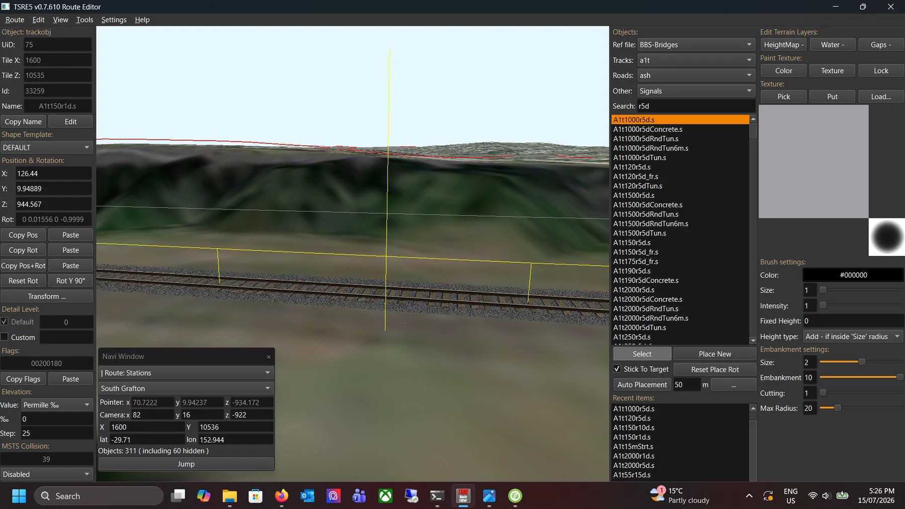
There are probably another twenty TSRE5 tricks waiting for me that will eventually make this workflow look primitive too.
That seems to be how this project works. Every couple of weeks I discover a button that would have saved me three hours earlier.
Then half the scenery came back from the dead
One of the stranger problems wasn’t related to track at all.
A heap of scenery objects simply weren’t appearing.
The files existed. The reference file had entries. Some of the categories appeared in TSRE5. But large chunks of the actual scenery library were just absent.
Eventually we went through the route .ref file properly and found several issues.
I fixed them, loaded the route again and suddenly an absurd amount of scenery appeared.
Buildings. Railway structures. Objects I had assumed simply didn’t work.
It was like somebody had quietly opened another warehouse behind the scenery menu.
Then there were the fibro houses.
The class appeared. The files existed. Everything looked right.
No houses.
Another fine-tooth-comb pass through the file...
And there they were.
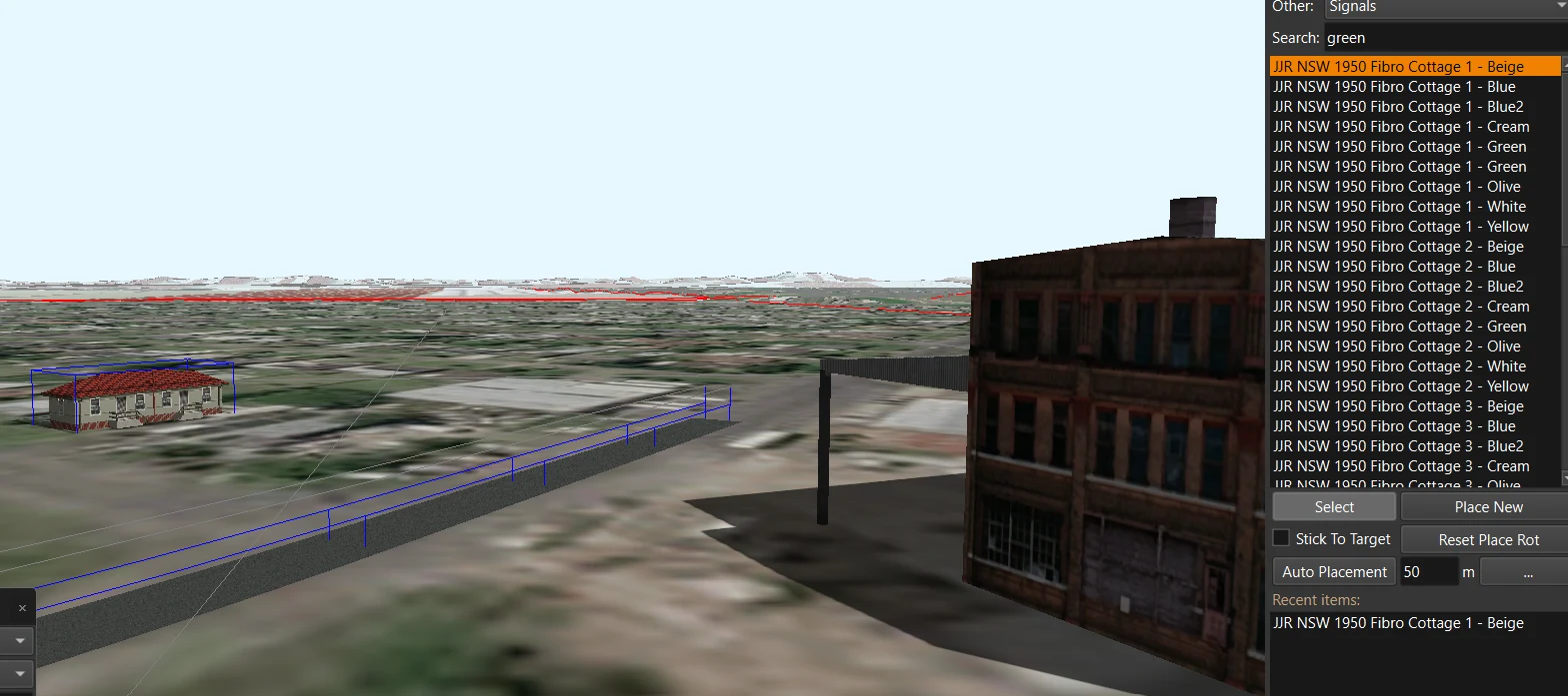
This was actually a pretty significant fix because it massively expanded the scenery I can use around Grafton.
And if I want the towns along this route to eventually feel like regional NSW rather than Generic Train Simulator Land™, those sorts of houses matter.
Grafton also briefly grew a mountain
Some bugs are complicated.
Some bugs require careful investigation.
And then there was this.
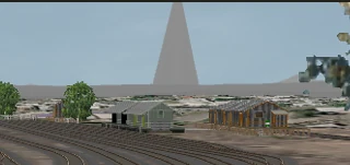
I enabled distant terrain and suddenly there was an enormous spike sticking into the sky beyond Grafton.
No subtle terrain error. No gentle hill where there shouldn’t be one. Just a geological spear trying to escape the planet.
So naturally I flew over to investigate it.
Found the offending terrain. Removed it. Done.
Route building is a highly scientific process.
Crossing into South Grafton
South Grafton is where the project has started becoming much more interesting to me.
North Grafton has plenty of complexity, but much of what I’m doing there can still be compared against things that exist today.
Once I started digging into South Grafton properly, that began to change.
I had historic photographs. Old railway plans. Track formations that had disappeared. Buildings that were gone. Sidings that no longer existed.
Suddenly the question wasn’t just, where does the railway go?
It became, what used to be here?
And that question is dangerous.
Because once you start asking it, you end up staring at eighty-year-old railway plans at midnight trying to work out where somebody put a coal stage.
South Grafton Station
Some of the historic photographs I found of South Grafton Station were incredibly useful.
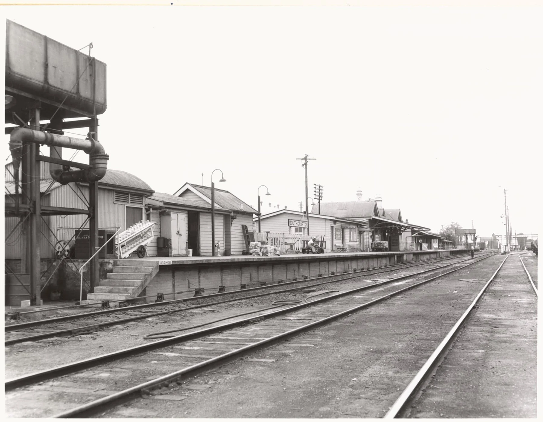
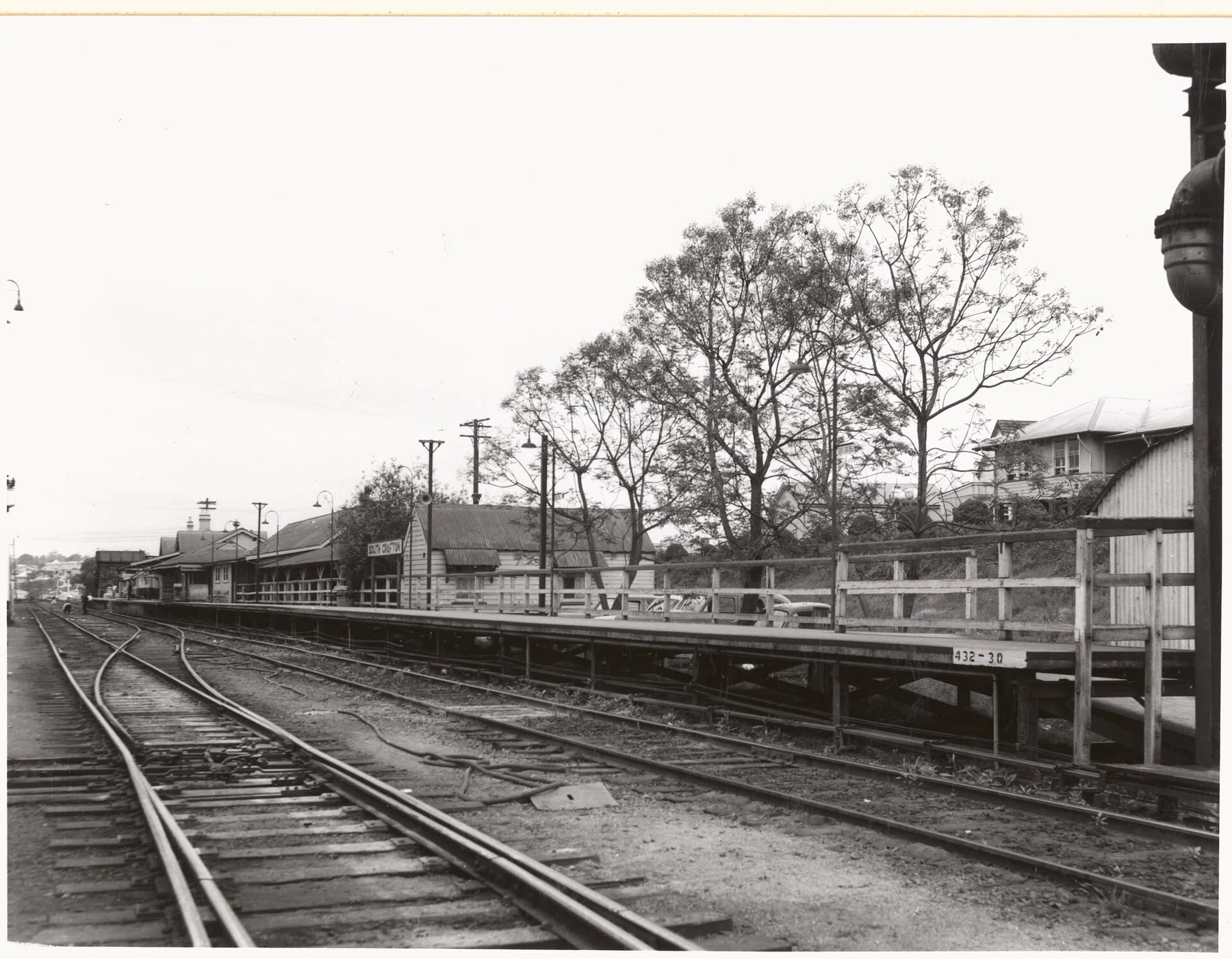
There is so much information packed into photographs like these.
The platform height. Buildings. Lighting. Track spacing. Water infrastructure. Goods sitting on the platform. Even little things like fences and telegraph poles start becoming useful once you’re trying to recreate the place rather than simply admire the photo.
This is where the historical material really starts earning its keep.
Satellite imagery tells me what South Grafton looks like now.
These photographs tell me what railway South Grafton felt like.
The yard was bigger than “put a turntable here”
Then I started getting deeper into the engine facilities.
I had already built the turntable and surrounding yard in TSRE5, but finding the proper plan made everything much easier to understand.
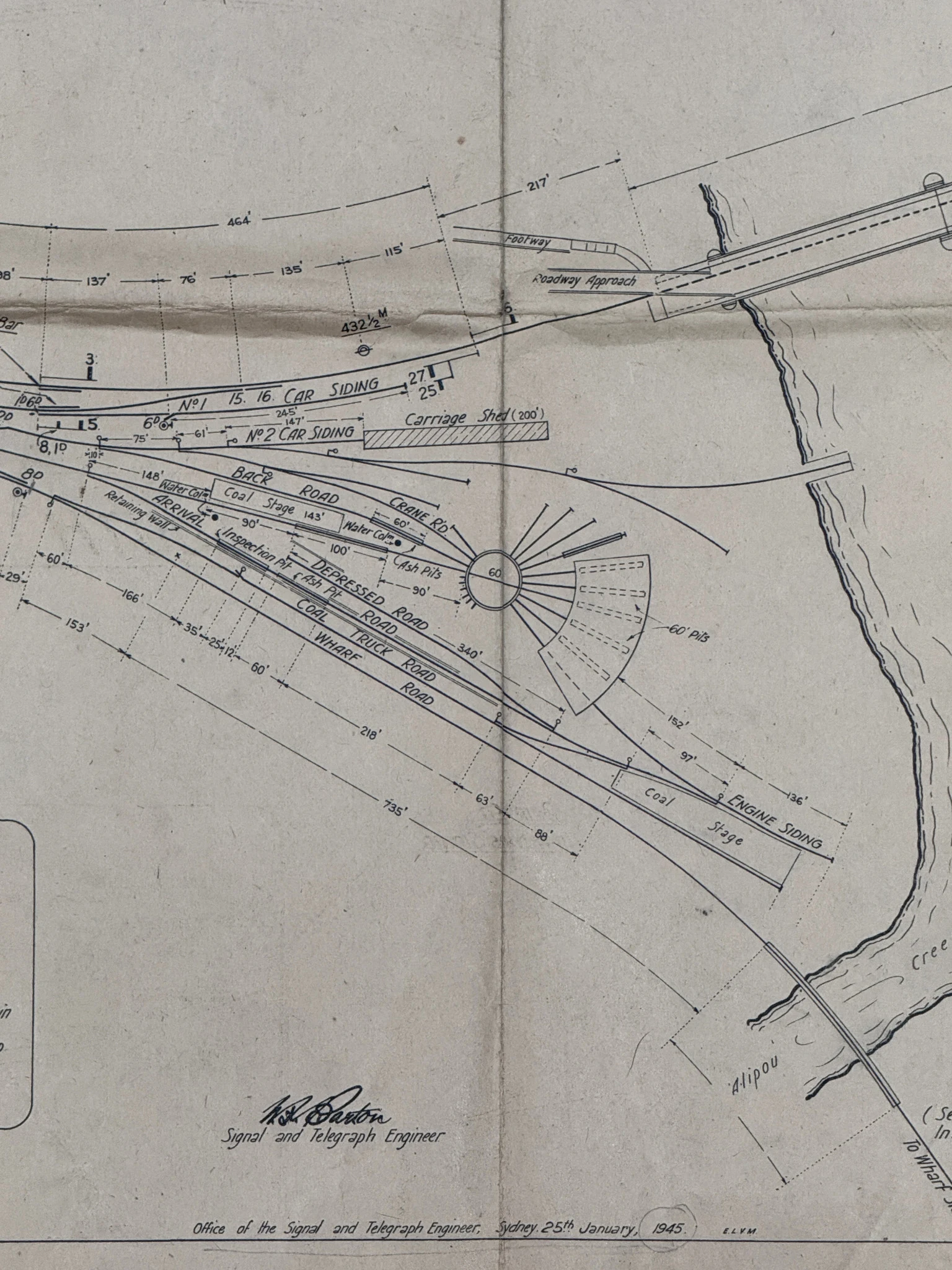
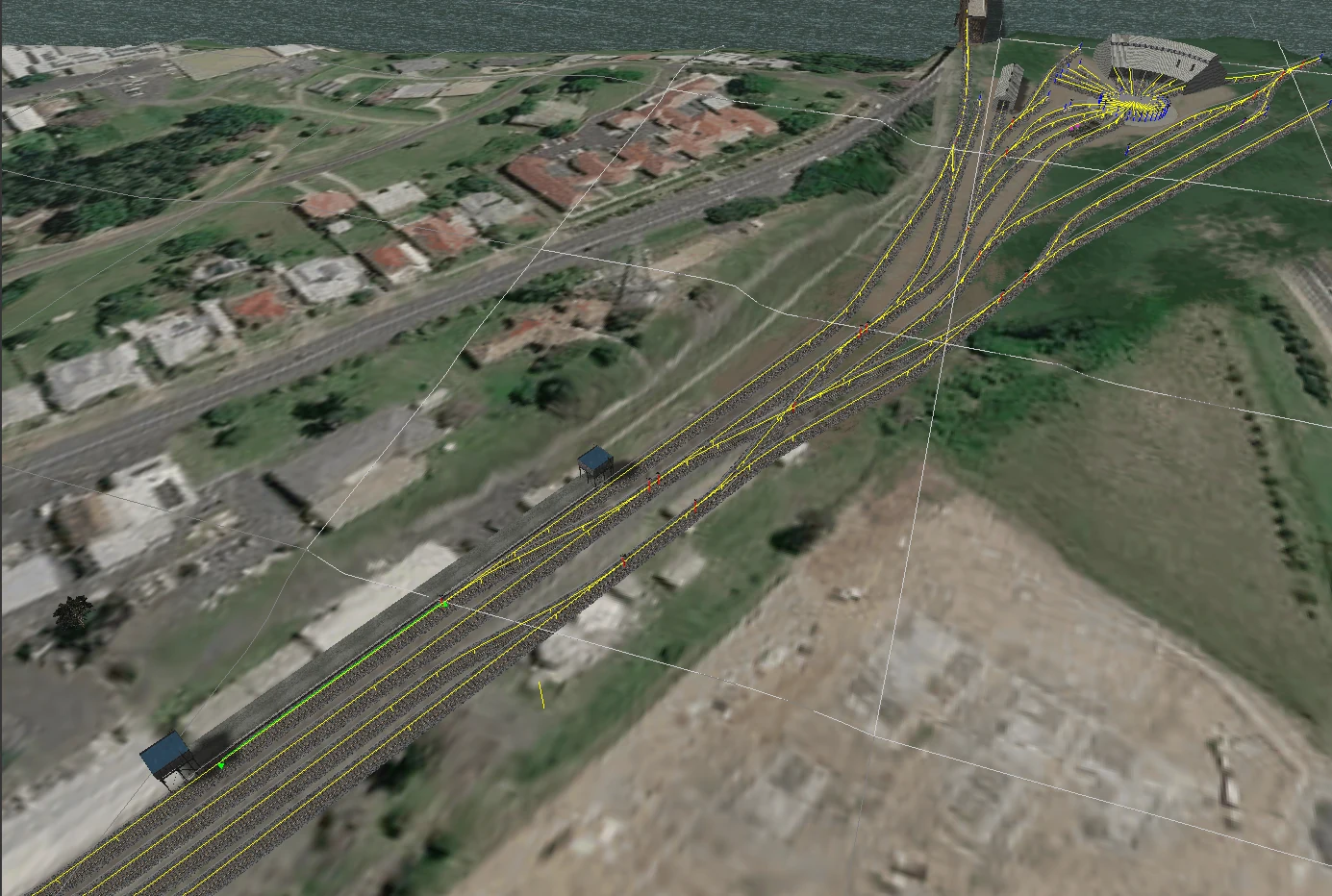
This plan is fantastic.
It doesn’t just show a circle marked “turntable”.
It shows the whole working area around it.
Engine siding. Coal stage. Coal wharf. Ash pit. Inspection pit. Depressed road. Back road. Carriage shed. And then the track continuing down toward the creek siding.
Suddenly all of those tracks I was laying had a purpose.
They weren’t just interesting lines spreading out from a turntable. They were part of a working locomotive facility.
This comparison is probably one of my favourite parts of the build so far.
An old engineering drawing on one screen. TSRE5 on the other. Slowly turning one into the other.
Naturally, I had to put trains on it
Of course, once the yard existed I immediately wanted to see whether it actually worked.
So the testing continued.
And, naturally, not everything went brilliantly first time.
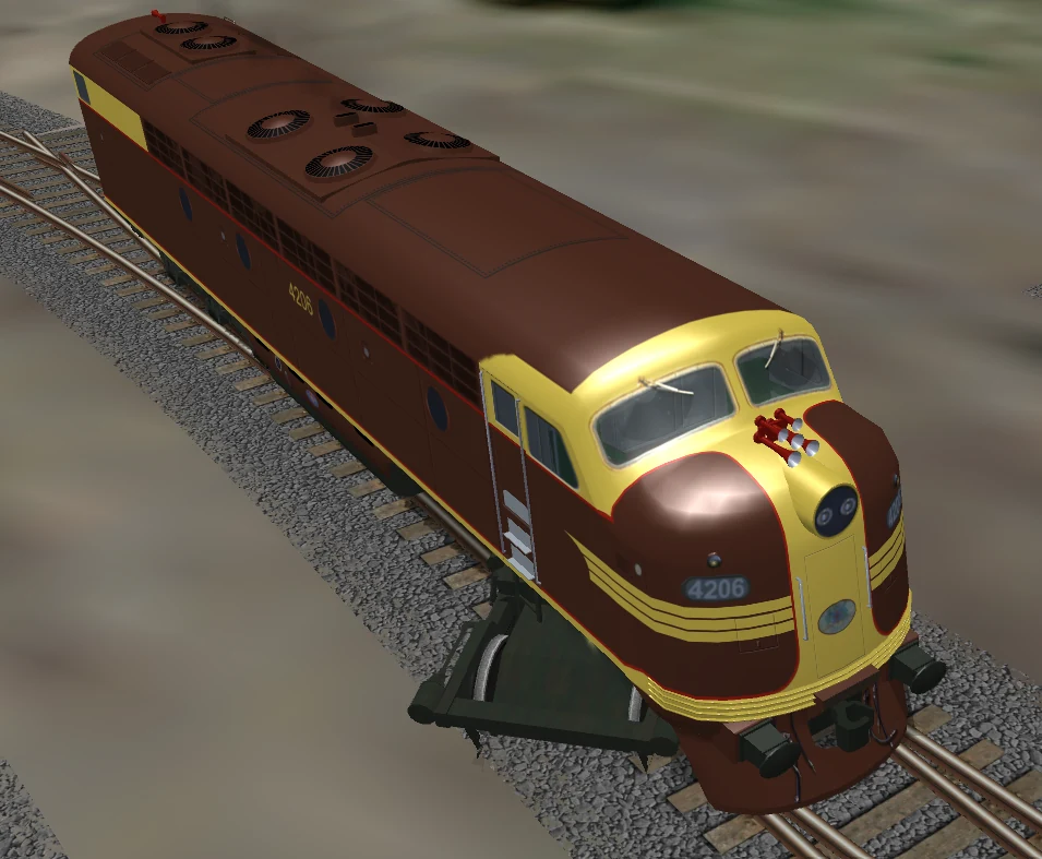
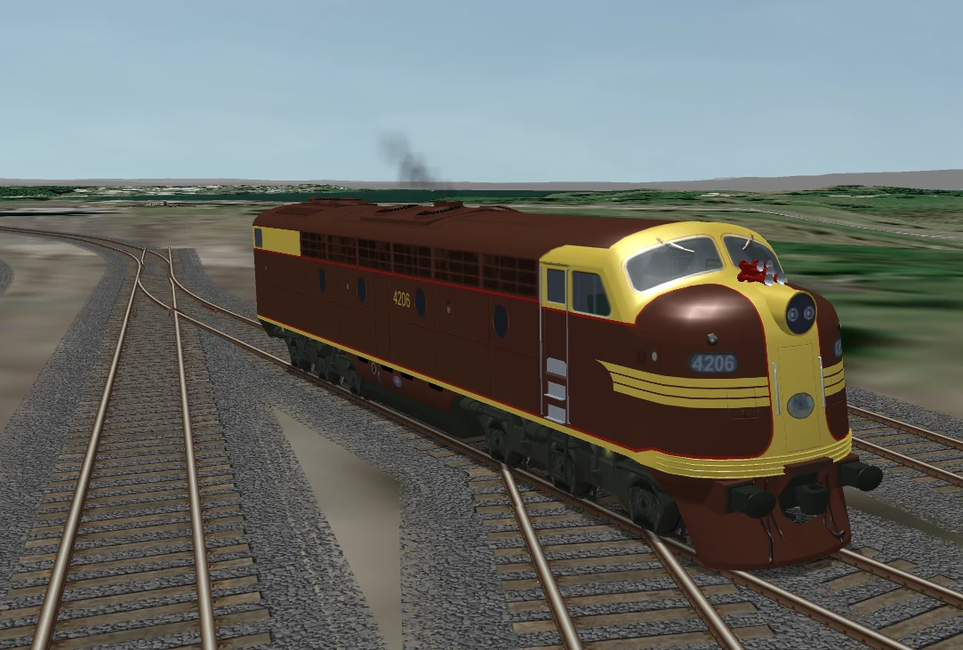
Back into TSRE5. Fix the track. Back into Open Rails. Try again.
This is becoming one of my favourite parts of building the route.
There’s something extremely satisfying about fixing a section in the editor and then immediately driving a locomotive through it to prove it works.
And then, because the turntable existed...
Well.
Obviously I had to.
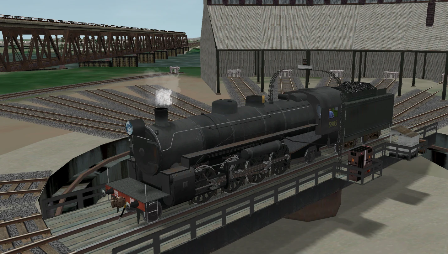
That shot was one of those little moments where the project stopped looking like track laid over satellite imagery and started looking like somewhere trains could actually live.
And then I found the abattoir siding
The latest bit of construction has pushed south from Tyson Street.
I’ve now laid the main line from there to roughly 250 metres beyond Hyde Street.
It’s not a massive distance, but while working through the area I went back to one of my old plans.
And noticed this:
GRAFTON ABATTOIRS SIDING
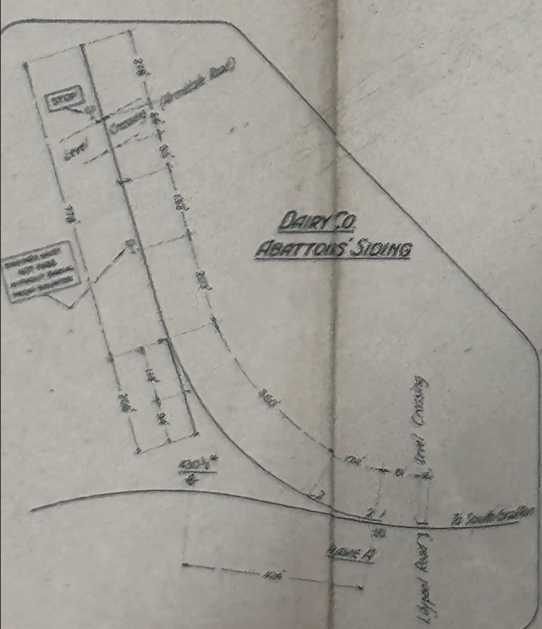
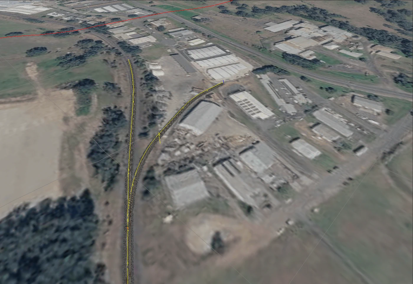
There it was.
Leaving the main line. Curving away. Running toward an industrial site that looks completely different today.
The siding itself is gone.
Most people travelling through the area today probably wouldn’t have any reason to know it was ever there.
But I had the plan.
Which, apparently, means I now have to rebuild it.
At the moment I’ve built roughly half of it.
And this might be the thing that has changed how I think about the whole project.
Following the existing North Coast Line is one thing. You can see it on satellite imagery. You can visit it. You can compare it with modern photographs.
But reconstructing something like this is completely different.
Now I’m comparing historic plans against modern terrain, looking for surviving clues and trying to work out where railway infrastructure disappeared into the landscape.
It’s basically railway archaeology.
Except instead of uncovering sleepers with a shovel, I’m sitting at a computer rotating track pieces by fractions of a degree.
So, yeah. Apparently I have been busy
This post started because I genuinely thought I hadn’t done enough on the project to write another one.
Looking back now, that seems slightly ridiculous.
North Grafton Station exists. The yard has grown substantially. I’ve driven trains through it and used those runs to find problems. I survived the Track Join From Hell. Dynamic track and I are now on speaking terms. I understand the TDB considerably better than I did. Terrain work has become faster. A huge chunk of missing scenery came back to life. Grafton briefly developed a mountain and then lost it again.
South Grafton now has a yard, turntable and engine facilities taking shape. Historic photographs and plans are directly influencing what I build. And an abattoir siding that disappeared decades ago is slowly coming back.
So no, I haven’t laid another hundred kilometres of railway.
But the project has definitely changed.
It’s becoming less about drawing the North Coast Line across a map and more about trying to recreate the railway landscape that existed around it.
And judging by that enginehouse plan, there’s still a creek siding waiting for me.
Fantastic.
I’m sure that won’t send me down another rabbit hole at all.
Next time...
Continue south. Finish the abattoir siding. Investigate the creek siding.
Probably discover another historical plan containing three more sidings I didn’t know existed.
Regret everything.
Keep building anyway.